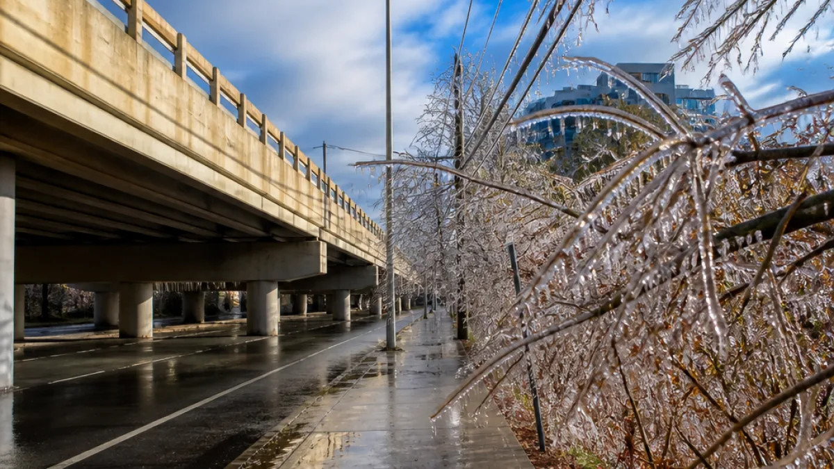
Ice storms are not the most common winter weather threat across the Northeast, but they can create serious problems in a short time when they occur. During Winter Weather Awareness Week, forecasters are highlighting the difference between snow, freezing rain and sleet — three forms of precipitation that can produce very different hazards across Connecticut.
The risk is not distributed evenly throughout the region. Ice storms are more frequently seen from northern New Jersey through the Hudson Valley and into southwestern Connecticut, although freezing precipitation can also reach New York City and Long Island. The conditions can be especially difficult because a storm may begin with liquid rain and leave behind a layer of ice that is not immediately obvious.
How freezing rain becomes ice
Freezing rain starts as liquid precipitation in a warmer layer of air above the ground. If temperatures at the surface are at or below 32 degrees, the drops freeze when they hit roads, sidewalks, trees, utility lines or other objects. The result is a coating of ice that can build on exposed surfaces and create widespread disruptions.
That process differs from sleet. Sleet consists of raindrops that freeze before reaching the ground after passing through a colder layer of air. Both types of precipitation can make travel and walking conditions dangerous, but freezing rain is particularly capable of coating infrastructure because it remains liquid until contact.
| Precipitation type | How it forms | Primary concern |
|---|---|---|
| Snow | Falls as ice crystals or flakes | Accumulation and reduced travel conditions |
| Freezing rain | Liquid drops freeze when they reach surfaces at or below 32 degrees | Ice on roads, sidewalks, trees and power lines |
| Sleet | Raindrops freeze before reaching the ground | Slick travel and walking surfaces |
A small amount can have a large effect
One of the central warnings in the forecast discussion is that it takes only a trace of freezing rain to produce significant impacts. Roads and sidewalks can become slick with little or no warning, creating difficulties for drivers and pedestrians even when the total amount of precipitation appears small.
Bridges, overpasses and elevated roadways are especially vulnerable. They are surrounded by colder air rather than being insulated by the ground, so their surfaces can freeze more quickly. That means a route that appears wet elsewhere may develop icy sections on elevated stretches.
Freezing rain also affects more than transportation. Ice can accumulate on tree branches and power lines, adding weight to structures that may already be exposed to winter winds. The combination can lead to damage and interruptions that extend beyond the period of precipitation itself.
What residents should watch for
The distinction between freezing rain and sleet matters because both can produce hazardous conditions in different ways. Freezing rain creates a coating on whatever it touches, while sleet arrives as small frozen particles. Either can leave roads and sidewalks slick, and the source report emphasizes that these hazards may develop with little warning.
- Watch for ice on bridges, overpasses and elevated roadways, which can freeze sooner than surrounding surfaces.
- Do not judge conditions solely by the amount of rain or sleet reported; even a thin layer of freezing rain can create major problems.
- Be alert to the potential for ice accumulation on tree branches and power lines, particularly when wind is also present.
- Recognize that sidewalks and other walking surfaces can become hazardous even when roads appear merely wet.
These conditions are among the reasons winter weather awareness focuses on preparation before a storm arrives. The danger is not limited to heavy snow or visibly deep accumulation. A storm that produces only a modest amount of freezing precipitation can still affect travel, walking routes and utility infrastructure throughout communities.
National Weather Service changes ice measurements
This winter, the National Weather Service is changing how it forecasts and reports ice accumulation. The agency will standardize its information around radial ice measurements, which describe the thickness of newly formed ice around tree branches or power lines.
Previously, forecasts and reports used flat ice amounts. That measurement describes the thickness of ice on horizontal surfaces such as vehicle roofs or deck railings. While that information can help show how much ice has fallen, it is less directly tied to the way ice loads cylindrical branches and power lines.
The shift is intended to place more emphasis on likely infrastructure impacts. Radial ice measurements better reflect the weight placed on trees and utility lines, particularly when wind is added to the equation. The National Weather Service will continue to express those amounts in hundredths of an inch and issue forecasts in six-hour periods.
Why the updated forecast matters
For Connecticut residents, the revised approach may make winter weather information more useful when a storm threatens ice. A measurement that relates more closely to branches and power lines can provide a clearer indication of the risks beyond road conditions, including possible damage to vegetation and utility infrastructure.
The warning remains straightforward: freezing precipitation does not have to be heavy to be disruptive. As winter approaches, understanding the difference between snow, freezing rain and sleet can help residents interpret forecasts and recognize why a seemingly minor storm may still make travel unsafe and place stress on trees and power lines.